

 By Barbara Zaragoza / San Diego Free Press
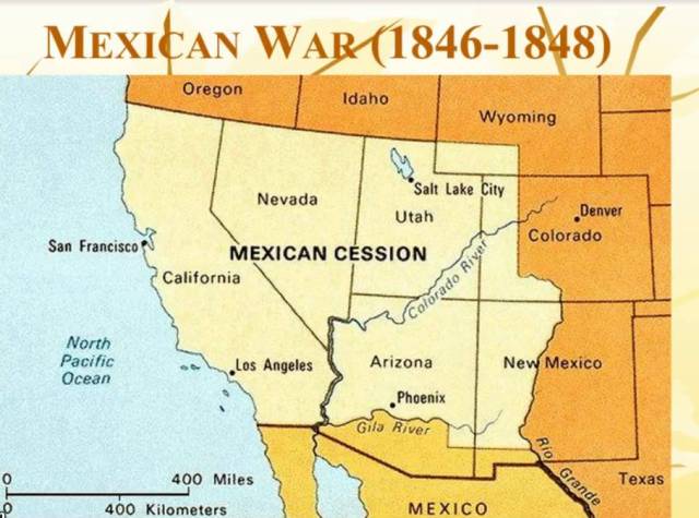
In 1848, the U.S.-Mexican War ended with the signing of the Treaty of Guadalupe Hidalgo. The treaty stipulated that Mexico relinquish 1.2 million square miles of its territory to the United States in return for $15 million. It also assigned a Joint U.S. and Mexican Boundary Commission to determine the exact location of the new boundary line.
The Commission consisted of a large caravan of men, including a commissioner and a surveyor for both sides. The drawing of the boundary line took two years to complete–from 1849 to 1851. The Joint Commission erected 52 boundary monuments with #1 overlooking the Pacific Ocean in what today is Border Field State Park.
Boundary Monument #258

(Originally boundary marker #1)
Boundary marker #1 was made of Italian marble and stretched 14 feet high. The Commission ordered it from a New York firm called “At the Sign of the Quadrant” and waited for it to be delivered by ship. Once the marble obelisk arrived, the Commission purportedly placed a time capsule underneath.
Boundary monument #1 became a popular tourist attraction. By some estimates, more than 100,000 visitors came each year by the end of the 19th century. A stagecoach line was set up that ran services between Old Town and the monument. A problem arose, however, in that tourists who came to this site broke off small chips as souvenirs. Over time, this significantly damaged the monument.[1]
With more settlement along the border, disputes arose over the boundary’s precise location. Both countries recognized the need to resurvey the line more precisely. (Only six monuments existed in California.) From 1892 to 1894, the Barlow-Blanco Commission began to place 258 boundary monuments across 689 miles of border. They started in El Paso, Texas and designated it boundary marker #1. As a consequence, the last marker, once considered the initial point at the Pacific Ocean, was re-numbered 258.[2] (The numbering system still remains from the Barlow-Blanco Commission, however, there are now 272 boundary monuments across the same stretch, the extra 14 marked as A’s and B’s.)

Colonel J.W. Barlow, chief of the American Boundary Commission, described the often dangerous work. “We started in at El Paso and from that point worked West steadily to San Diego. We passed over much desert and some valleys that would be fertile if there was any way of storing water. We also passed over many mountain ranges, notably the Sierra Madres. A great deal of the country was rough and wild.”[3]
When Barlow reached the Pacific Ocean, the boundary monument was in terrible shape. The Commission sent the obelisk to a San Diego marble yard to get it fixed. When they placed the monument back at the initial point, they protected it with a steel picket fence.
Boundary Monument #255

Photographs show that the Commission also placed a similar picket fence around boundary monument #255, which still exists today at the San Ysidro Port of Entry. During this time, Tia Juana was a city that existed both on the U.S. and Mexican side. There were no fences or borders, only two custom houses erected by both governments in the 1870’s. A devastating flood, however, destroyed the town of Tia Juana in 1891. Most residents then moved 300 feet above sea level to the city’s current location on exclusively the Mexican side.
Boundary monument #255 washed away during that flood and the Barlow-Blanco Commission put up a new one about 1,000 feet away on higher ground with the accompanying steel picket fence. A postcard shows a stagecoach service arriving at #255, signifying that this monument was probably another tourist destination. It was also the only one made of granite.
Pictures show that during the 1911 International Workers of the World Insurrection in Tijuana, Boundary Monument #255 was the location where insurrectionists surrendered to Captain Alfred Wilcox. In 1917 officials gathered at this monument for a “Friendship Fiesta,” including Governor Estaban Cantu, San Diego Mayor Louis J. Wilde and John D. Spreckels. By 1918 it was also a destination along the 60-Hour Overland Touring Sedan from Canada To Mexico.
This second boundary monument still stands in its same location in a parking lot on Mexican federal property. #255 is also right beside the one-hundred year old Tijuana-Tecate train station, which is still in operation.
Two Boundary Monuments #255

In 1979 an agricultural worker found the mid-section of the original boundary monument #255. At first, it caused quite a little flap as the Baja California newspaper El Heraldo said that since the marker was found in San Ysidro, it meant that this district of San Diego was actually part of Mexico.
It was, of course, a joke. The marker was put into a warehouse in Old Town. The San Ysidro Chamber of Commerce, however, insisted that it should return to San Ysidro. Local historian Joyce Hettich headed the selection site, although we are unclear what location she recommended. Whatever she said, a picture in an out-of-print book San Diego & Arizona: The Impossible Railroad shows the boundary monument sitting in front of the newly built San Ysidro Trolley of 1981. At some point, this “first” boundary monument was moved across the street where it remains today. You can see it beneath the Highway I-5 pedestrian bridge.
Boundary Monument #252

While tourists considered boundary monuments #255 and #258 to be famous spots, the others, all constructed of either iron or masonry, seemed less popular. Boundary Monument #252 is the last of the seven boundary monuments shared by the cities of Tijuana and San Diego. Currently located at the far end of the maquiladora warehouses in Otay Mesa, this monument is made of masonry. It’s elegant, but also cracked. Dirt piles up alongside #252. Its dilapidated condition begs the question: “Who cleans and keeps up these boundary monuments?”
The International Boundary and Water Commission has been responsible for the upkeep of the boundary monuments as well as water-rights treaties between the two nations since its creation in 1889. The archives in El Paso hold the records of joint monument engineering and cleanings and show that the monuments were next maintained in 1926. The engineers created a report that included pictures of #255 and #258 with new paint on their steel picket fences.
The archives also contain a “Joint report of the principal engineers on a maintenance program for the international land boundary monument” that came out on November 8, 1973. At that time, the engineers proposed a permanent program of maintenance, explaining, “The monuments should be maintained as necessary to assure at all times their proper location, permanence, and visibility.”
The report proposed that the monuments be inspected at least every five years and be maintained at least every ten years. The work and maintenance needed to be shared, with Mexico maintaining Monuments 1 to 79 and 206 to 258, while the U.S. was responsible for monuments 80 to 204-A. That meant all the boundary markers between Tijuana and San Diego were to be cleaned and maintained by Mexico.
Boundary Monuments #253, 254, 256, 257

Boundary monuments #253, 254, 256 and 257 still exist. They are made of iron and #257, in particular, sits atop a craggy mountain where migrants historically have come in wait of darkness in order to cross the border. The violence at this location can be seen by the bullet holes that penetrate through the iron.
Each of these boundary monuments also tells the story of a more contemporary history. In 1994 the Clinton Administration launched “Operation Gatekeeper,” wherein the federal government erected recycled military landing mat across the entire U.S.-Mexico land border, ending several yards inside the Pacific Ocean, ostensibly trying to “part the sea.” The military landing mat was strategically placed approximately 2-3 feet away from the actual U.S.-Mexico boundary line, so that the decision to erect a wall could be made by the United States unilaterally.

According to Steve Smullen, the USIBWC Area Operations Manager, after the federal government erected the military landing mat, the IBWC insisted that they still needed access to the boundary monuments. Border Patrol acquiesced and created doors next to each monument. The doors were cut into the landing mat at an unknown date. They have a locked bolt on the American side only, for which border patrol and the IBWC have keys.

Like boundary monument #255, boundary monument #257 is on federal property and therefore difficult to visit unless you ask for permission. The others: #252, 253, 254, 256 and 258 are easily accessible to Mexican residents. The military landing mat, interestingly, has become part of the boundary monument history because graffiti artists on the Mexican side often create installations along the walls. Migrants also etch on the landing mat, including names of their loved ones or the cities from where they have traveled.

After September 11, 2001, tightened security had a definitive impact upon the boundary monuments. Congress passed the REAL ID Act in 2005, which stipulated a double fence along the entire United States-Mexico border. Section 102 of the act gave the Secretary of the Department of Homeland Security the right to waive any law that would impede the rapid construction of the walls. That included the National Historic Preservation Act that protected the boundary monuments. In particular, No. 258 at the Pacific Ocean was redesigned in 2011 so that the obelisk stood exclusively on the Mexican side and was cut off to Americans by a thick mesh fence.

While the boundary monuments still exist, they are generally unknown to most Americans since they are neither visible nor accessible on the U.S. side. Only curious historians and filmmakers from abroad venture to locate them, crossing into Mexico and searching the military landing mat for a sighting.

The obelisk on the Mexican side, however, has become a symbol of U.S.-Mexican relations. You can find a row of the obelisks, painted white, at the migrants’ camp near the canal in Tijuana. Along a freeway near the border fence in Tijuana, a roundabout also has a red obelisk with crosses darting out like thorns. Across the street, a migrant group on the Day of the Dead in 1998 placed more than 300 crosses along the military landing mat to commemorate those who died trying to cross into the United States from 1995-1998. The group has added many more hundreds of crosses since then.
First appeared in the South Bay Historical Society Bulletin (April 2015)
[1] Charles Hughes, “On the Boundary Line: The U.S. Military on California’s Border with Mexico 1849-1948,” Report for the California Department of Parks and Recreation, San Diego Coast District, January 2009, 13. Boundary Monument #1 was also known as ‘La Mojonera’.
[2] The border between the U.S. and Mexico follows the course of the Rio Grande (a natural boundary line) until it hits the land boundary that begins in El Paso, Texas and runs to the Pacific Ocean in San Diego. The total length of the border is 1,954 miles.
[3]–, “The Boundary Survey,” San Diego Union 27 Sept. 1894, 2.


Interesting…